
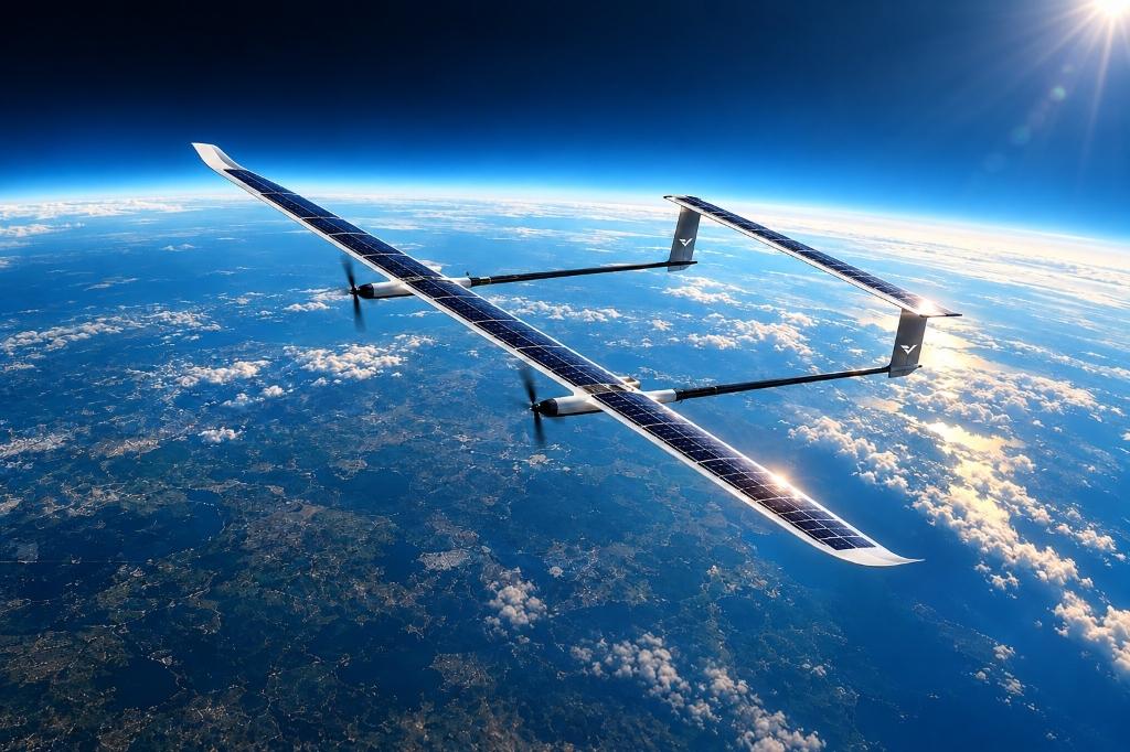
WHERE DRONES MEET SATELLITES.
PERSISTENT STRATOSPHERIC FLIGHT.
Drone-grade agility with satellite-grade endurance. Developing indigenous High Altitude Pseudo-Satellites (HAPS) for 72+ hours persistent surveillance, hyperspectral imaging, and wide-area sovereign communications from the stratosphere.
THE STRATOSPHERIC LAYER
Between tactical UAVs and orbital infrastructure, High Altitude Pseudo-Satellites bridge the critical operational dead zone with persistent wide-area coverage from the stratosphere.
TACTICAL UAV
- •30–90 minute battery endurance
- •Constant recovery, refuel & redeployment
- •Localized tactical line-of-sight coverage
- •Vulnerable to tropospheric weather
LEVITATE HAPS
- •72+ hours continuous on-station loiter
- •59,000 – 72,000 ft stratospheric cruise
- •Solar-augmented diurnal energy cycle
- •Up to ~12 kg modular payload bay
- •Low-RCS stealth carbon-composite airframe
ORBITAL SATELLITE
- •Hours-to-days revisit gaps between passes
- •Fixed orbital path; cannot loiter over live events
- •High deployment cost (₹50 Cr – ₹500 Cr+)
- •Contested orbit & anti-satellite vulnerability
PRELIMINARY DESIGN TARGETS
TRL-2 validated design targets engineered for continuous stratospheric flight, to be validated through full-scale flight testing.
Fixed-wing HAPS class; ultra-high aspect ratio carbon-composite airframe engineered for aerodynamic efficiency in thin stratospheric air.
Stratospheric cruise band located well above tropospheric storms, cloud cover, and civil aviation flight routes.
Solar-augmented perpetual day/night cycle targeting continuous multi-day loitering over critical areas of interest.
Modular dual-sensor bay designed specifically for hyperspectral imaging payloads and EO/IR stabilized thermal camera suites.
Total integrated system mass: carbon-fiber airframe structure, dual payload package, and high-density energy storage system.
Mission-dependent stratospheric loiter speed tuned for low power consumption, steady station-keeping, and wind vector holding.
Upper-wing photovoltaic solar harvesting arrays paired with high energy density lithium-ion batteries for continuous in-flight recharge.
Beyond Visual Line of Sight operational command enabled via satellite telemetry links and high-altitude airborne mesh networking.
Reduced radar cross-section stealth airframe profile designed for sensitive defense intelligence and border surveillance operations.
HARDWARE IN THE AIR.
INTELLIGENCE ON THE GROUND.
A comprehensive dual-layer architecture combining an ultra-high aspect ratio stratospheric aerial platform with an autonomous ground intelligence and analytics engine.
AUTONOMOUS HAPS AIRFRAME
TACTICAL DATA & ANALYTICS ENGINE
STRATEGIC MISSION VERTICALS
Dual-use from day one: persistent national defense ISR and commercial agritech / environmental intelligence deployed in parallel.
DEFENSE & BORDER PERSISTENT ISR
Eliminates the satellite revisit gap along contested borders, strategic choke points, and maritime Exclusive Economic Zones (EEZ).
HYPERSPECTRAL SENSING & CLIMATE
Satellite-grade hyperspectral sensing resolving crop stress, vegetation moisture indices, chemical plumes, wildfire perimeters, and glacier shifts.
SOVEREIGN TACTICAL COMMUNICATIONS
Airborne stratospheric cell tower and mesh gateway projecting persistent wide-area broadband, tactical defense links, and emergency connectivity.
TRL-2 COMPLETED. TARGETING FLIGHT-TESTED TRL-4.
Conceptual design and aerodynamic energy simulations finalized; actively advancing through subscale prototyping toward full-scale stratospheric flight demonstration.
TRL-2 COMPLETE → TRL-4 TARGET
Conceptual design, aerodynamic modeling, weight/power balance, and payload interface architecture defined. Target: flight-tested full-scale prototype.
ARMY DESIGN BUREAU
Interest from Army Design Bureau (ADB) pipeline pending formal iDEX registration; actively advised by an ex-Indian Army & iDEX project mentor.
NON-DILUTIVE GRANTS
Grant applications submitted under Startup India Seed Fund Scheme (SISFS) and DRDO Technology Development Fund (TDF) for hardware acceleration.
DAP-2020 & MAKE-IN-INDIA
Aligned with liberalized Drone Rules 2021 and Defence Acquisition Procedure (DAP-2020) provisions granting statutory preference to indigenous platforms.
“Persistent ISR is no longer optional for high-altitude operations — platforms like HAPS close the coverage gaps that cost lives and strategic ground.”
ENGINEERED IN INDIA
Levitate Dynamics Private Limited is developing indigenous aerospace platforms focused on persistent stratospheric flight, surveillance and communications.
START A MISSION CONVERSATION
For defense, telecommunications, research, investment and strategic partnership inquiries, contact the Levitate Dynamics team.
Narendra Nagar, Nagpur,
Maharashtra 440015, India.